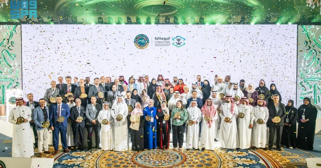
The 10th Arab Forum on Geographical Names concluded on November 12, 2024, in Jeddah, Saudi Arabia, under the patronage of Minister of Defense Prince Khalid bin Salman bin Abdulaziz. The three-day forum, held from November 10 to 12, was organized by the General Authority for Survey and Geospatial Information (GEOSA) and inaugurated by Governor of Jeddah Prince Saud bin Abdullah bin Jalawi. Delegations from 22 Arab countries, along with United Nations teams and international organizations, participated in the event.
Context and Background
The forum, themed “Strengthening Relationships and Links Between Arab States in the Field of Geographical Names,” served as a platform for experts and officials to discuss the standardization and preservation of geographical names across the Arab world. Saudi Arabia’s hosting of the event underscores its commitment to fostering regional cooperation in geospatial sciences and cultural heritage. The forum also hosted the 10th Forum of the Arab Division of Experts in Geographical Names, which issued recommendations for member states based on the topics discussed.
Key Details
Over 120 research papers were presented, and more than 70 speakers participated in over 10 specialized scientific sessions. An accompanying exhibition featured over 15 government, private, and non-profit organizations, along with a display of more than 25 publications related to geographical names. The forum aimed to raise awareness of the importance of geographical names, integrate them with modern technologies such as Geographic Information Systems (GIS), and encourage research and innovation in this field.
Implications and Impact
The forum’s outcomes are expected to strengthen joint Arab efforts in geospatial data management, enhance cultural identity through shared naming conventions, and support the region’s ability to leverage geospatial information for economic development. The recommendations from the forum, endorsed by experts from 22 Arab nations, provide a framework for improving data coordination and leveraging geospatial technologies for sustainable development across the Arab world.
Vision 2030 Alignment
Hosting the 10th Arab Forum on Geographical Names aligns closely with Saudi Vision 2030’s goals of promoting cultural exchange, advancing technological innovation, and supporting regional leadership. By strengthening Arab cooperation in geospatial sciences, the Kingdom reinforces its role as a hub for knowledge sharing and modern infrastructure development, contributing to the realization of a vibrant society and a thriving economy.
20 Questions
Q1. What was the 10th Arab Forum on Geographical Names?
A1. It was a three-day forum held in Jeddah, Saudi Arabia, from November 10 to 12, 2024, focused on strengthening Arab cooperation in the field of geographical names under the patronage of the Minister of Defense.
Q2. Who hosted the forum in Saudi Arabia?
A2. The General Authority for Survey and Geospatial Information (GEOSA) hosted the forum under the patronage of Minister of Defense Prince Khalid bin Salman bin Abdulaziz.
Q3. How many countries participated in the forum?
A3. Delegations from 22 Arab countries participated, along with United Nations teams and international organizations focused on geographical names.
Q4. What was the theme of the forum?
A4. The theme was “Strengthening Relationships and Links Between Arab States in the Field of Geographical Names,” emphasizing collaboration in geospatial data and cultural heritage.
Q5. Who inaugurated the forum?
A5. The forum was inaugurated by Governor of Jeddah Prince Saud bin Abdullah bin Jalawi.
Q6. How many research papers were presented at the forum?
A6. Over 120 research papers were presented by experts and specialists from various countries and organizations.
Q7. How many speakers participated in the forum?
A7. More than 70 speakers participated in over 10 specialized scientific sessions, sharing diverse perspectives and expertise.
Q8. What organizations were featured in the accompanying exhibition?
A8. Over 15 government, private, and non-profit organizations were featured, along with a display of more than 25 publications related to geographical names.
Q9. What is the Arab Division of Experts in Geographical Names?
A9. It is a specialized body that supports coordination among Arab states on geographical naming standards and was part of the forum’s activities.
Q10. What recommendations came from the forum?
A10. The forum issued recommendations for Arab member states based on discussions, aiming to enhance cooperation in geographical names and geospatial data management.
Q11. How does the forum support Arab cultural identity?
A11. By standardizing geographical names, the forum helps preserve and strengthen Arab cultural heritage and shared identity across the region.
Q12. What modern technologies were discussed at the forum?
A12. The forum highlighted the integration of geographical names with modern technologies such as Geographic Information Systems (GIS) to improve mapping and data analysis.
Q13. Why did Saudi Arabia host this forum?
A13. Saudi Arabia hosted the forum to support joint Arab efforts, strengthen cultural identity, and foster exchange of ideas in the field of geographical names.
Q14. What is the role of GEOSA in Saudi Arabia?
A14. GEOSA is the General Authority for Survey and Geospatial Information, responsible for geospatial data management and survey activities in the Kingdom.
Q15. How does the forum relate to Vision 2030?
A15. The forum aligns with Vision 2030 by promoting technological innovation, cultural exchange, and regional leadership, contributing to a vibrant society and thriving economy.
Q16. Who is the Minister of Defense in Saudi Arabia?
A16. Prince Khalid bin Salman bin Abdulaziz is the Minister of Defense and Chairman of the Board of Directors of GEOSA, who patronized the forum.
Q17. When was the forum held?
A17. The forum took place from November 10 to 12, 2024, in Jeddah, Saudi Arabia.
Q18. What is the significance of geographical names for Arab states?
A18. Geographical names are crucial for mapping, cultural identity, and coordination in geospatial data, supporting sustainable development and regional integration.
Q19. How many scientific sessions were held at the forum?
A19. More than 10 specialized scientific sessions were held, covering topics such as research, technology, and policy related to geographical names.
Q20. What is the expected impact of the forum’s recommendations?
A20. The recommendations aim to strengthen cooperation among Arab states, improve geospatial data management, and support sustainable development goals in the region.
Reader Feedback
We value your thoughts. Please share your feedback on this article.
Your feedback helps us improve our coverage.