


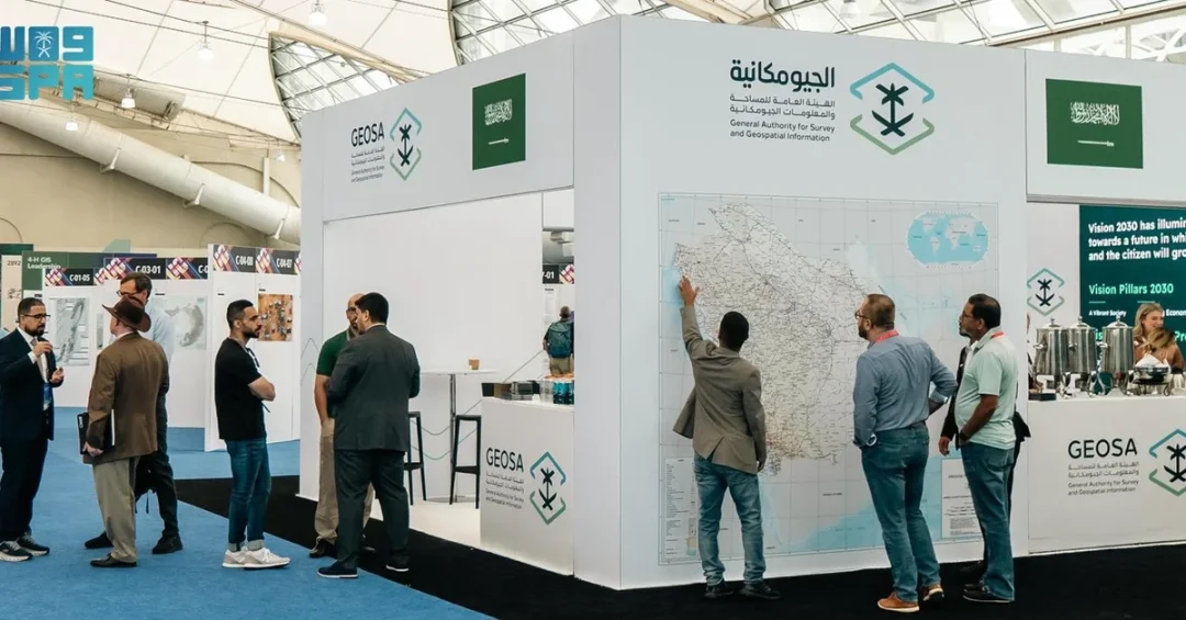
The Saudi General Authority for Survey and Geospatial Information (GEOSA) actively participated in the 2024 Esri User Conference in San Diego, United States, from July 15 to 19, according to the Saudi Press Agency (SPA). The conference, a premier global event in surveying, geospatial information, and geographic information systems (GIS), attracted over 20,000 participants from more than 150 countries, providing a platform for Saudi Arabia to showcase its advancing capabilities in geospatial technology.
Context and Background
The Esri User Conference is widely recognized as the world’s largest gathering of GIS professionals, offering a comprehensive program of scientific sessions, workshops, and technical presentations. These sessions explore cutting-edge advancements in geospatial information technology and intelligence, fostering sustainable and innovative solutions that empower various sectors to achieve their key objectives. GEOSA’s participation underscores Saudi Arabia’s commitment to leveraging geospatial data for national development and global collaboration.
Key Details
GEOSA’s delegation engaged with international experts, sharing insights and learning about the latest trends in GIS and surveying. The authority’s presence at the conference highlights its role in advancing the Kingdom’s geospatial infrastructure, which is critical for urban planning, environmental management, and infrastructure development. By participating in such a global forum, GEOSA reinforces Saudi Arabia’s position as a leader in geospatial innovation.
Implications and Impact
Saudi Arabia’s active involvement in the Esri User Conference has significant implications for its regional and international partnerships. It opens avenues for collaboration with other nations and organizations, facilitating knowledge exchange and technology transfer. This participation also supports the Kingdom’s efforts to diversify its economy and enhance its technological capabilities, aligning with broader goals of sustainable development and digital transformation.
Vision 2030 Alignment
This engagement directly supports Saudi Vision 2030, which aims to transform the Kingdom into a global investment powerhouse and a hub for innovation. By investing in geospatial technologies and international cooperation, Saudi Arabia is building a knowledge-based economy and improving the quality of life for its citizens. GEOSA’s participation in the 2024 Esri User Conference exemplifies the Kingdom’s proactive approach to achieving its long-term strategic objectives.
20 Questions
Q1. What is the Saudi General Authority for Survey and Geospatial Information (GEOSA)?
A1. GEOSA is the Saudi government agency responsible for surveying and geospatial information, playing a key role in national mapping, urban planning, and infrastructure development to support Vision 2030.
Q2. What was the 2024 Esri User Conference?
A2. The 2024 Esri User Conference was a major global event for GIS professionals, held in San Diego from July 15 to 19, featuring scientific sessions, workshops, and technical presentations on geospatial technology.
Q3. How many participants attended the 2024 Esri User Conference?
A3. The conference drew over 20,000 participants from more than 150 countries, making it the largest gathering of GIS professionals worldwide.
Q4. Why did GEOSA participate in the conference?
A4. GEOSA participated to showcase Saudi Arabia’s expertise in geospatial information, learn about cutting-edge advancements, and foster international collaboration in surveying and GIS.
Q5. What are the benefits of GEOSA’s participation for Saudi Arabia?
A5. It enhances Saudi Arabia’s global standing in geospatial technology, facilitates knowledge exchange, and supports the Kingdom’s digital transformation and economic diversification goals.
Q6. What is the significance of geospatial information for Saudi Arabia?
A6. Geospatial information is vital for urban planning, environmental management, and infrastructure projects, enabling data-driven decision-making and sustainable development across various sectors.
Q7. How does GEOSA’s work align with Vision 2030?
A7. GEOSA’s work supports Vision 2030 by advancing technology, innovation, and infrastructure, contributing to a knowledge-based economy and improved quality of life.
Q8. What types of sessions were held at the conference?
A8. The conference featured scientific sessions, workshops, and technical presentations on the latest advancements in GIS, geospatial intelligence, and sustainable solutions.
Q9. What is the role of GIS in achieving sustainable development?
A9. GIS enables efficient resource management, urban planning, and environmental monitoring, which are essential for sustainable development and achieving key objectives in various sectors.
Q10. How does GEOSA collaborate internationally?
A10. GEOSA engages with global experts and organizations at events like the Esri User Conference to share knowledge, adopt best practices, and form partnerships that enhance its capabilities.
Q11. What are the key objectives of GEOSA?
A11. GEOSA aims to provide accurate geospatial data, support national development projects, and promote innovation in surveying and GIS to meet Saudi Arabia’s strategic needs.
Q12. How does the conference help Saudi Arabia’s regional partnerships?
A12. It opens avenues for collaboration with other nations, facilitating technology transfer and joint initiatives that strengthen regional ties and mutual development.
Q13. What is the importance of international conferences for Saudi Arabia?
A13. They provide platforms to showcase Saudi achievements, learn from global best practices, and build networks that support the Kingdom’s economic and technological advancement.
Q14. How does GEOSA contribute to Saudi Arabia’s digital transformation?
A14. By integrating advanced geospatial technologies, GEOSA enhances data-driven decision-making and supports digital infrastructure projects across government and private sectors.
Q15. What are the applications of geospatial intelligence?
A15. Geospatial intelligence is used in urban planning, disaster management, agriculture, and transportation, helping optimize resources and improve services for citizens.
Q16. How does GEOSA support infrastructure development in Saudi Arabia?
A16. GEOSA provides precise mapping and surveying data that guide the planning and execution of major infrastructure projects, ensuring efficiency and sustainability.
Q17. What makes the Esri User Conference a global leader?
A17. It is the largest and most comprehensive GIS event, attracting top professionals and showcasing cutting-edge technologies and solutions that shape the future of geospatial information.
Q18. How does Saudi Arabia benefit from global geospatial advancements?
A18. By adopting new technologies, Saudi Arabia can improve planning, resource management, and service delivery, supporting its goals for a diversified and sustainable economy.
Q19. What future collaborations might arise from GEOSA’s participation?
A19. Potential collaborations include joint research, technology exchange, and capacity-building initiatives with international organizations and companies, enhancing Saudi Arabia’s geospatial ecosystem.
Q20. How does this participation reflect Saudi Arabia’s global role?
A20. It demonstrates Saudi Arabia’s active engagement in global technological forums, reinforcing its position as a forward-looking nation committed to innovation and international cooperation.
Reader Feedback
We value your thoughts. Please share your feedback on this article.
Your feedback helps us improve our coverage.