


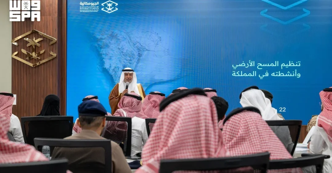
The General Authority for Survey and Geospatial Information (GEOSA) has launched a series of workshops aimed at regulating land surveying activities, enhancing professional standards, and supporting Saudi Vision 2030 objectives. The initiative, announced on July 23, 2026, seeks to strengthen the Kingdom’s regulatory framework and improve the reliability of geospatial data, which is critical for infrastructure and development projects.
Context and Background
Land surveying serves as the foundation for numerous development initiatives, including urban planning, transportation networks, and investment projects. Accurate geospatial data ensures efficient resource utilization and informed decision-making. GEOSA, as the national authority responsible for surveying and geospatial information, plays a pivotal role in aligning these activities with international best practices and Saudi Arabia’s strategic goals.
Key Details
The inaugural workshop was attended by GEOSA President Dr. Eng. Mohammed bin Yahya Al Sayel, along with representatives from over 60 government, private-sector, and academic entities, as well as international experts. The event outlined a proposed regulatory framework, including the standardization of land surveying activities, professional certification requirements, and the adoption of advanced technical standards.
In his opening remarks, Dr. Al Sayel emphasized the direct correlation between high-quality surveying work and the success of development projects. “Land surveying is the backbone of infrastructure and urban development,” he stated. “Ensuring its accuracy and reliability is essential for achieving Vision 2030’s goals.”
Implications and Impact
The workshops are expected to elevate the professionalism and technical capabilities of land surveyors in Saudi Arabia, fostering greater confidence among investors and developers. By aligning with international standards, the Kingdom positions itself as a leader in geospatial innovation, which is crucial for large-scale projects such as NEOM, The Red Sea Project, and Qiddiya.
Furthermore, the initiative supports Saudi Arabia’s broader economic diversification efforts by creating a more robust regulatory environment for key sectors reliant on accurate geospatial data, including construction, logistics, and smart city development.
Vision 2030 Alignment
This initiative directly contributes to Saudi Vision 2030 by modernizing the Kingdom’s geospatial infrastructure and enhancing the efficiency of development projects. By establishing a world-class regulatory framework, GEOSA ensures that Saudi Arabia remains at the forefront of technological advancement and sustainable development, reinforcing its position as a global hub for innovation and investment.
20 Questions
Q1. What is the purpose of GEOSA’s new workshops?
A1. The workshops aim to regulate land surveying activities, enhance professional standards, and improve the reliability of geospatial data in line with Vision 2030.
Q2. Who attended the inaugural workshop?
A2. GEOSA President Dr. Eng. Mohammed bin Yahya Al Sayel, representatives from 60+ entities, and international experts attended.
Q3. Why is land surveying important for development?
A3. Accurate surveying ensures efficient resource use, informed decision-making, and the success of infrastructure and urban projects.
Q4. How does this initiative support Vision 2030?
A4. It modernizes geospatial infrastructure, aligns with international standards, and enhances project efficiency, supporting economic diversification.
Q5. What sectors benefit from improved geospatial data?
A5. Construction, logistics, smart cities, and large-scale projects like NEOM and The Red Sea Project benefit.
Q6. What are the key components of the proposed regulatory framework?
A6. The framework includes standardized surveying activities, professional certification, and advanced technical standards.
Q7. How does GEOSA contribute to Saudi Arabia’s global standing?
A7. By adopting international best practices, GEOSA positions the Kingdom as a leader in geospatial innovation.
Q8. What role does Dr. Al Sayel play in this initiative?
A8. As GEOSA President, he oversees the implementation of regulatory improvements and professional standards.
Q9. How will these workshops impact investors?
A9. They will increase confidence in the accuracy and reliability of Saudi Arabia’s geospatial data, attracting more investment.
Q10. What are the long-term goals of this initiative?
A10. To establish a world-class regulatory framework and sustain Saudi Arabia’s leadership in geospatial technology.
Q11. How does this align with international practices?
A11. The initiative adopts technical and regulatory standards that match global best practices.
Q12. What is the significance of involving private-sector representatives?
A12. Their involvement ensures the framework meets industry needs and fosters collaboration between sectors.
Q13. How will this initiative improve urban planning?
A13. Reliable geospatial data enables more precise and efficient urban development and infrastructure projects.
Q14. What technologies might be incorporated into the new standards?
A14. Advanced tools like LiDAR, drones, and AI-driven mapping could be integrated.
Q15. How does this support Saudi Arabia’s economic diversification?
A15. By enhancing sectors like construction and logistics, it reduces reliance on oil and promotes sustainable growth.
Q16. What is the timeline for implementing the new regulations?
A16. While specifics are not provided, the workshops mark the first step toward phased implementation.
Q17. How will academic institutions contribute?
A17. They will help develop training programs and research to advance geospatial expertise.
Q18. What are the expected outcomes for surveyors?
A18. Surveyors will gain higher professional standards, certification, and access to advanced tools and methodologies.
Q19. How does this initiative relate to smart city projects?
A19. Accurate geospatial data is essential for planning and managing smart cities, ensuring efficiency and sustainability.
Q20. What message does this send to the international community?
A20. It demonstrates Saudi Arabia’s commitment to innovation, regulatory excellence, and global leadership in geospatial technology.
Reader Feedback
We value your thoughts. Please share your feedback on this article.
Your feedback helps us improve our coverage.