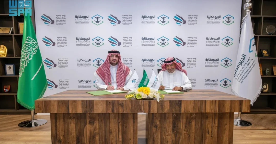
The General Authority for Survey and Geospatial Information (GEOSA) and the Saudi Federation for Cyber Security and Programming (SAFCSP) signed a memorandum of cooperation on September 17, 2024, in Riyadh, to strengthen the integration of drones in the geospatial sector. The agreement was formally signed by GEOSA President Dr. Eng. Mohammed Yahya Alsayel and SAFCSP Chairman Faisal bin Saud Al-Khamisi, marking a strategic step toward advancing Saudi Arabia’s geospatial capabilities.
Context and Background
This memorandum builds on Saudi Arabia’s broader efforts to modernize its technological infrastructure under Vision 2030. GEOSA, as the regulatory authority for surveying and geospatial information in the Kingdom, oversees the collection and management of critical geospatial data used in urban planning, infrastructure development, and environmental monitoring. SAFCSP, a national body focused on building local expertise in cybersecurity, software development, and drone technology, complements this mission by fostering a skilled workforce aligned with global standards. The partnership signals a coordinated push to leverage drone technology for more accurate and efficient geospatial data collection.
Key Details
The memorandum outlines several specific initiatives, including the development of a unified drone platform through a partnership between GEOSA and SAFCSP. The agreement also aims to improve coordination in the use of geospatial technology with drones, support the growth of the geospatial sector, and increase the number of practitioners and companies operating in this field. Capacity-building measures include national training programs, exchange of expertise, and shared educational resources. A joint strategic initiative is planned to discover and support emerging talents and interests in geospatial and drone technologies, ensuring a pipeline of skilled professionals to drive the sector forward.
Implications and Impact
This agreement is expected to accelerate the adoption of drone-based geospatial solutions across various industries in Saudi Arabia, from oil and gas exploration to smart city development. By fostering investment and localizing drone-related industries, the partnership will create new business opportunities and reduce reliance on foreign technology and expertise. Regionally, it positions Saudi Arabia as a leader in the integration of drones and geospatial data, enhancing its competitive edge in the Middle East. The collaboration also supports the Kingdom’s goals of diversification and innovation, contributing to economic growth and technological self-sufficiency.
Vision 2030 Alignment
The partnership between GEOSA and SAFCSP directly supports Saudi Arabia’s Vision 2030 objectives by promoting technological innovation, building national expertise, and fostering a knowledge-based economy. Through enhanced use of drones for geospatial data, the Kingdom can improve infrastructure planning, environmental management, and urban development, all while creating new jobs and localizing strategic industries. This initiative is a clear step toward realizing the leadership’s vision of a prosperous and sustainable Saudi Arabia that is integrated into the global digital economy.
20 Questions
Q1. What is GEOSA?
A1. GEOSA is the General Authority for Survey and Geospatial Information, responsible for regulating surveying and geospatial data in Saudi Arabia to support planning and development.
Q2. What is SAFCSP?
A2. SAFCSP is the Saudi Federation for Cyber Security and Programming, a national body focused on building local expertise in cybersecurity, software development, and drones based on global best practices.
Q3. When was the memorandum of cooperation signed?
A3. The memorandum was signed on September 17, 2024, in Riyadh, Saudi Arabia.
Q4. Who signed the agreement on behalf of GEOSA?
A4. The agreement was signed by GEOSA President Dr. Eng. Mohammed Yahya Alsayel.
Q5. Who signed the agreement on behalf of SAFCSP?
A5. The agreement was signed by SAFCSP Chairman Faisal bin Saud Al-Khamisi.
Q6. What is the main purpose of this agreement?
A6. The main purpose is to strengthen the integration of drones in the geospatial sector through improved coordination, capacity building, and innovation.
Q7. What is a unified drone platform?
A7. A unified drone platform is a collaborative system to streamline drone operations and data collection, developed jointly by GEOSA and SAFCSP.
Q8. How will this agreement support companies?
A8. It aims to increase the number of practitioners and companies in the geospatial field, facilitating company entry and fostering investment in drone technologies.
Q9. What is the role of education in this memorandum?
A9. The memorandum includes plans to exchange expertise, share educational resources, and develop national capacity building programs in geospatial and drone technologies.
Q10. Will this agreement create jobs?
A10. Yes, by expanding the geospatial and drone sector and localizing industries, the agreement is expected to create new job opportunities for Saudi nationals.
Q11. How does this agreement benefit Saudi Arabia’s economy?
A11. It fosters investment, localizes drone-related industries, and promotes innovation, contributing to economic diversification and growth under Vision 2030.
Q12. Is this agreement part of Vision 2030?
A12. Yes, it aligns with Vision 2030 by advancing technological innovation, building national expertise, and fostering a knowledge-based economy.
Q13. What industries will benefit from improved drone integration?
A13. Industries such as oil and gas, urban planning, smart city development, environmental monitoring, and infrastructure will benefit from more accurate geospatial data.
Q14. How will this improve geospatial data collection?
A14. Drones enable faster, more precise data collection over large areas, improving efficiency and accuracy for surveying and mapping applications.
Q15. Will the agreement support research and development?
A15. Yes, it aims to advance research, development, and consultancy in geospatial and drone technologies.
Q16. What is the strategic initiative mentioned in the memorandum?
A16. A joint strategic initiative to discover and support interests in geospatial and drone technologies among Saudi youth and professionals.
Q17. How does SAFCSP contribute to this partnership?
A17. SAFCSP provides expertise in cybersecurity, programming, and drone technology, ensuring adherence to global best practices and standards.
Q18. How does GEOSA regulate geospatial information?
A18. GEOSA sets policies, standards, and regulations for surveying and geospatial data collection, management, and use across the Kingdom.
Q19. What is the international significance of this agreement?
A19. It positions Saudi Arabia as a leader in drone and geospatial integration in the Middle East, enhancing its regional competitive edge and technological reputation.
Q20. What is the expected outcome of this partnership?
A20. The partnership is expected to accelerate the adoption of drone-based geospatial solutions, foster a skilled workforce, and drive innovation, supporting Saudi Arabia’s long-term development goals.
Reader Feedback
We value your thoughts. Please share your feedback on this article.
Your feedback helps us improve our coverage.