


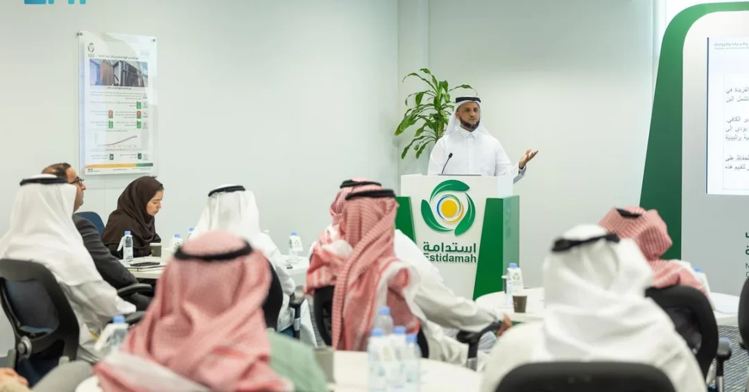
The National Research and Development Center for Sustainable Agriculture (Estidamah) hosted a workshop in Riyadh on August 29, 2024, focusing on geographical indicators for crop yields, in collaboration with the Ministry of Environment, Water, and Agriculture, the Saudi Authority for Intellectual Property, and the UN Food and Agriculture Organization (FAO). The event aimed to raise awareness about the significance of geographical indicators and their connection to sustainable agricultural development, highlighting their social, economic, and marketing benefits as well as the challenges they pose in Saudi Arabia.
Context and Background
Geographical indicators are signs used on products that have a specific geographical origin and possess qualities or a reputation due to that origin, such as Saudi dates or coffee. The workshop brought together local and international experts to discuss the legal and regulatory frameworks necessary for protecting these indicators, which can enhance market access and premium pricing for farmers. This initiative is part of broader efforts under Vision 2030 to diversify the economy and strengthen the agricultural sector.
Key Details
The workshop featured a panel of experts who explored topics including the integration of geographical indicators into rural development programs. Participants emphasized the role of these indicators in preserving cultural heritage and improving the livelihoods of farming communities. Estidamah, in partnership with the Ministry of Environment, Water, and Agriculture, is working to align local practices with international standards, supported by the Saudi Authority for Intellectual Property and the FAO.
Implications and Impact
By promoting geographical indicators, Saudi Arabia aims to boost food security and reduce reliance on imports, a key priority of Vision 2030. The initiative also supports the Kingdom’s leadership in sustainable agriculture, fostering innovation and collaboration with global bodies like the FAO. The workshop is expected to lead to better protection of traditional products, enhancing their competitiveness in international markets and contributing to economic diversification.
Vision 2030 Alignment
This workshop aligns directly with Saudi Arabia’s Vision 2030 goals of enhancing food security and self-sufficiency. By leveraging local and international expertise, Estidamah is strengthening the capabilities of the agricultural sector, ensuring long-term sustainability and economic growth. The Kingdom’s commitment to sustainable agriculture through geographical indicators underscores its role as a global leader in innovation and rural development, paving the way for a prosperous future.
20 Questions
Q1. What is Estidamah?
A1. Estidamah is the National Research and Development Center for Sustainable Agriculture in Saudi Arabia, dedicated to promoting sustainable farming practices and achieving food security under Vision 2030.
Q2. What was the purpose of the workshop?
A2. The workshop aimed to raise awareness about geographical indicators for crop yields and their role in sustainable agricultural development, highlighting their social, economic, and marketing benefits.
Q3. Who organized the workshop?
A3. The workshop was organized by Estidamah in collaboration with the Ministry of Environment, Water, and Agriculture, the Saudi Authority for Intellectual Property, and the UN Food and Agriculture Organization.
Q4. What are geographical indicators?
A4. Geographical indicators are signs used on products with a specific geographical origin and qualities or reputation due to that origin, such as Saudi dates or coffee.
Q5. Why are geographical indicators important for agriculture?
A5. They help protect unique regional products, enhance market access, support premium pricing, and preserve cultural heritage, all of which boost farmer incomes and sustainable development.
Q6. How does this workshop support Vision 2030?
A6. It supports Vision 2030 goals of enhancing food security, self-sufficiency, and economic diversification by strengthening the agricultural sector through innovation and international collaboration.
Q7. What topics were discussed at the workshop?
A7. Topics included legal and regulatory frameworks for geographical indicator protection, their role in rural development, and their economic and social benefits for farming communities.
Q8. Who participated in the workshop?
A8. Local and international experts, representatives from the Ministry of Environment, Water, and Agriculture, the Saudi Authority for Intellectual Property, and the FAO participated.
Q9. What is the role of the Ministry of Environment, Water, and Agriculture?
A9. The ministry collaborates with Estidamah to align agricultural practices with Vision 2030, supporting sustainable farming, food security, and the protection of geographical indicators.
Q10. How does the Saudi Authority for Intellectual Property contribute?
A10. The authority helps develop and enforce legal frameworks for protecting geographical indicators, ensuring compliance with international standards.
Q11. What is the FAO’s role in this workshop?
A11. The FAO provided international expertise and guidance on best practices for implementing geographical indicators to support sustainable agriculture and rural development.
Q12. What are the benefits of geographical indicators for farmers?
A12. They enable premium pricing, better market access, and recognition of quality, which can increase farmer incomes and preserve local agricultural traditions.
Q13. What challenges do geographical indicators face in Saudi Arabia?
A13. Challenges include building awareness, establishing robust legal protections, and ensuring consistent quality standards across regions.
Q14. How can geographical indicators help Saudi Arabia’s economy?
A14. They boost agricultural exports, diversify the economy, and create new market opportunities, aligning with Vision 2030’s economic transformation goals.
Q15. Are geographical indicators used for Saudi products?
A15. Yes, they can be applied to unique Saudi products like dates, coffee, and honey, helping to protect their origin and increase their global value.
Q16. How does the workshop promote sustainable agriculture?
A16. It encourages practices that preserve natural resources, promote biodiversity, and support rural communities, reducing environmental impact.
Q17. What is the link between geographical indicators and rural development?
A17. They help develop local economies by creating jobs, preserving traditional knowledge, and boosting tourism in rural areas.
Q18. How does Saudi Arabia plan to implement geographical indicators?
A18. Through collaboration with ministries, international organizations like the FAO, and building legal frameworks to protect and market regional products.
Q19. What is the expected outcome of the workshop?
A19. Increased awareness and collaboration among stakeholders, leading to better protection of geographical indicators and enhanced sustainable agriculture in Saudi Arabia.
Q20. How can geographical indicators help in international trade?
A20. They provide a competitive advantage by certifying product quality and origin, which can boost Saudi exports and strengthen trade relationships globally.
Reader Feedback
We value your thoughts. Please share your feedback on this article.
Your feedback helps us improve our coverage.