


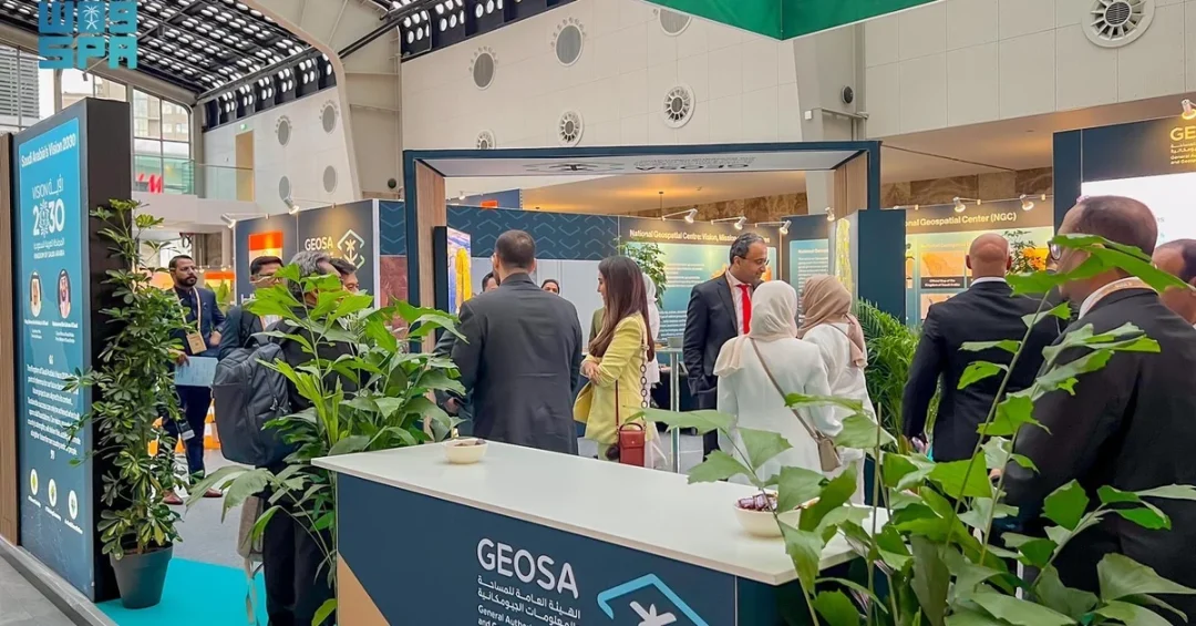
The Kingdom of Saudi Arabia, represented by the General Authority for Survey and Geospatial Information, is participating as a strategic partner in the Geospatial World Forum, held from May 13 to 16, 2024, in Rotterdam, the Netherlands. This participation underscores the Kingdom’s commitment to advancing its geospatial capabilities and integrating them into its economic development strategy.
Context and Background
The Geospatial World Forum is a premier global event that convenes experts, policymakers, and industry leaders in the geospatial sector. This year’s theme, “Geospatial Transition: Powering the World Economy,” highlights the growing importance of geospatial data and technology in driving economic growth and innovation. With over 300 specialized speakers and more than 55 pavilions showcasing the latest advancements, the forum serves as a vital platform for knowledge exchange and collaboration.
Key Details
During the opening session, the President of the General Authority for Survey and Geospatial Information, Dr. Eng. Mohammed Al Sayel, delivered a keynote address. He emphasized that the Saudi economy has achieved continuous growth in recent years, attributing part of this success to the strategic use of geospatial information. Al Sayel underscored the essential role of geospatial data in enabling informed decision-making and highlighted the necessity of robust geospatial infrastructure to sustain economic growth. He also mentioned ongoing collaboration with the World Bank to study the economic impact of geospatial information in the Kingdom, as well as partnerships with international organizations to align with global standards in geospatial governance and management.
Implications and Impact
The Kingdom’s active participation in this forum sends a strong signal to the international community about its dedication to leveraging geospatial technology for sustainable development. By engaging with global experts and showcasing its initiatives, Saudi Arabia is positioning itself as a leader in the geospatial sector. This collaboration is expected to facilitate the transfer of knowledge and best practices, ultimately enhancing the Kingdom’s national geospatial infrastructure and capacity building.
Vision 2030 Alignment
This strategic partnership aligns with Saudi Arabia’s Vision 2030, which prioritizes economic diversification and technological advancement. By investing in geospatial infrastructure and fostering international cooperation, the Kingdom is building a solid foundation for a knowledge-based economy, improving quality of life, and ensuring sustainable development. The insights gained from the forum will contribute to the realization of Vision 2030’s goals, empowering Saudi Arabia to play a pivotal role in the global digital economy.
20 Questions
Q1. What is the Geospatial World Forum?
A1. The Geospatial World Forum is a global event that brings together professionals, policymakers, and industry leaders in the geospatial sector to discuss developments, share insights, and showcase technologies. The 2024 edition is held in Rotterdam, Netherlands, from May 13 to 16.
Q2. Who is representing Saudi Arabia at the forum?
A2. The Kingdom of Saudi Arabia is represented by the General Authority for Survey and Geospatial Information (GASGI), with its President, Dr. Eng. Mohammed Al Sayel, attending as a key speaker.
Q3. What is the theme of the 2024 Geospatial World Forum?
A3. The 2024 theme is “Geospatial Transition: Powering the World Economy,” emphasizing the growing importance of geospatial data in driving economic growth and innovation globally.
Q4. Where and when is the forum taking place?
A4. The forum is taking place in Rotterdam, the Kingdom of the Netherlands, from May 13 to 16, 2024.
Q5. What role is Saudi Arabia playing at the forum?
A5. Saudi Arabia is participating as a strategic partner, highlighting its commitment to advancing geospatial capabilities and collaborating with international experts.
Q6. Why is geospatial information important for Saudi Arabia?
A6. Geospatial information is vital for decision-making across various sectors, enabling better planning, resource management, and economic growth. It supports infrastructure development and contributes to the achievement of Vision 2030 objectives.
Q7. What did Dr. Mohammed Al Sayel emphasize in his speech?
A7. He emphasized the continued growth of the Saudi economy and the critical role of geospatial information in enabling decision-making, while stressing the need for robust geospatial infrastructure to support this growth.
Q8. How is Saudi Arabia collaborating with the World Bank?
A8. The General Authority is conducting studies with the World Bank to assess the economic impact of geospatial information in the Kingdom, which will inform future investments and policy.
Q9. What other international collaborations is Saudi Arabia pursuing?
A9. Saudi Arabia is working with international organizations to align with global standards for geospatial information governance, management, and standards, ensuring interoperability and best practices.
Q10. How does this participation benefit Saudi Arabia?
A10. It allows the Kingdom to share its achievements, learn from global leaders, and foster partnerships that enhance its geospatial capabilities, contributing to economic diversification and technological advancement.
Q11. What is the significance of the theme “Geospatial Transition”?
A11. The theme highlights the shift toward geospatial technologies as key enablers of economic growth, reflecting the sector’s evolution from mapping to comprehensive data-driven solutions.
Q12. What are some applications of geospatial information?
A12. Applications include urban planning, transportation, environmental monitoring, agriculture, disaster management, and navigation, among many others that rely on accurate location data.
Q13. How does geospatial information support Vision 2030?
A13. It supports Vision 2030 by enabling smart city development, efficient resource management, and evidence-based policy making, which are essential for building a diversified and sustainable economy.
Q14. What is the role of the General Authority for Survey and Geospatial Information?
A14. GASGI is the government entity responsible for national surveying, geodetic data, and geospatial information, ensuring the availability and quality of data for public and private sectors.
Q15. How many speakers are at the forum?
A15. The forum features over 300 specialized speakers in the field of geospatial information, offering diverse perspectives and expertise.
Q16. How many exhibition pavilions are at the forum?
A16. There are more than 55 pavilions showcasing the latest technology and solutions in the geospatial sector.
Q17. What kind of knowledge exchange occurs at the forum?
A17. The forum facilitates exchange of experiences, best practices, and innovative solutions through presentations, workshops, and networking, helping participants stay abreast of developments.
Q18. How is Saudi Arabia building its national geospatial infrastructure?
A18. Sheikh Al Sayel mentioned that Saudi Arabia is developing its national geospatial infrastructure according to best global practices, focusing on standards, governance, and capacity building.
Q19. What are the economic implications of geospatial information?
A19. Geospatial information can enhance productivity, reduce costs, improve decision-making, and foster new industries, contributing significantly to economic growth and competitiveness.
Q20. What is the expected outcome of Saudi Arabia’s participation?
A20. The participation is expected to strengthen international cooperation, attract investment in geospatial technologies, and position the Kingdom as a leader in the field, supporting its long-term vision.
Reader Feedback
We value your thoughts. Please share your feedback on this article.
Your feedback helps us improve our coverage.