


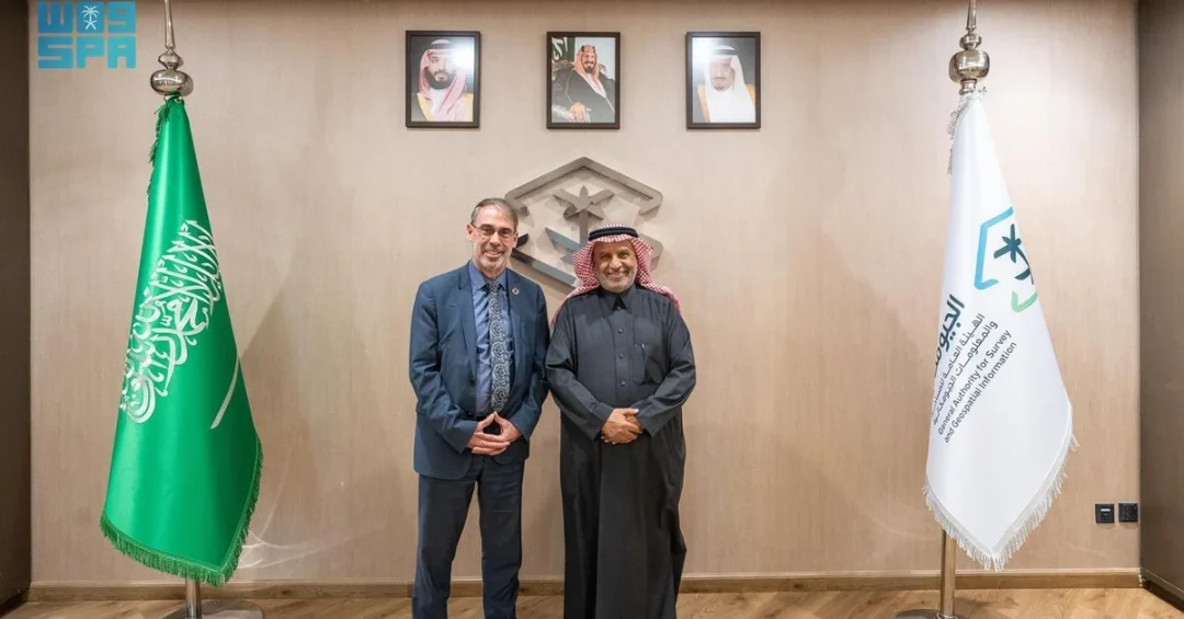
RIYADH — Dr. Eng. Mohammad bin Yahya Al Sayel, President of the General Authority for Survey and Geospatial Information (GEOSA), received Stefan Schweinfest, Secretary of the United Nations Committee of Experts on Global Geospatial Information Management (UNGGIM), on February 6, 2025. The meeting took place on the sidelines of the 12th Plenary Meeting of UNGGIM-Arab States and the fifth session of the High-Level Group for the Integrated Geospatial Information Framework, hosted by the Kingdom in Jeddah from February 2-6.
Context and Background
GEOSA is Saudi Arabia’s lead agency for regulating surveying, geospatial information, and imaging. The Kingdom has been actively building a comprehensive national geospatial infrastructure aligned with the Integrated Geospatial Information Framework (IGIF) and international best practices. Saudi Arabia also leads the Arab Committee of Experts on Geospatial Information Management and hosts its General Secretariat, underscoring its regional leadership in the field.
Key Details
During the meeting, Dr. Al Sayel and Schweinfest reviewed GEOSA’s key initiatives, including the future Saudi geospatial information ecosystem, governance of geospatial data, and formulation of policies and standards. Discussions also covered the latest developments regarding the Kingdom’s hosting of the UN Global Geospatial Ecosystem Center of Excellence, a major initiative in coordination with national and international entities. Schweinfest commended the Kingdom’s global leadership in geospatial information, its contributions to international committees, and its efforts to promote geospatial awareness worldwide.
Implications and Impact
The meeting reaffirms Saudi Arabia’s growing role in global geospatial governance. By hosting the UN Global Geospatial Ecosystem Center of Excellence and leading regional bodies, the Kingdom is positioning itself as a hub for geospatial innovation. This supports data-driven decision-making across sectors such as urban planning, environmental monitoring, and smart city development, benefiting both Saudi Arabia and partner nations.
Vision 2030 Alignment
GEOSA’s work directly supports Vision 2030 by enabling a digital, data-driven economy. The development of a robust geospatial infrastructure facilitates smart governance, infrastructure planning, and sustainable development. The Kingdom’s leadership in international geospatial forums enhances its global standing and contributes to the Vision’s goal of positioning Saudi Arabia as a hub for innovation and technology.
20 Questions
Q1. What is GEOSA?
A1. GEOSA stands for the General Authority for Survey and Geospatial Information, the Saudi government agency responsible for regulating surveying, geospatial data, and imaging in the Kingdom.
Q2. Who is Dr. Eng. Mohammad bin Yahya Al Sayel?
A2. He is the President of GEOSA and oversees Saudi Arabia’s geospatial sector, including its international collaborations and alignment with Vision 2030.
Q3. Who is Stefan Schweinfest?
A3. He is the Secretary of the UN Committee of Experts on Global Geospatial Information Management (UNGGIM), the leading UN body on geospatial data governance.
Q4. When did the meeting take place?
A4. The meeting occurred on February 6, 2025, during the 12th Plenary Meeting of UNGGIM-Arab States in Jeddah.
Q5. What is UNGGIM?
A5. The United Nations Committee of Experts on Global Geospatial Information Management is a UN body that coordinates global geospatial data policies and standards.
Q6. What is the Integrated Geospatial Information Framework (IGIF)?
A6. IGIF is a global framework that helps countries develop their geospatial information infrastructure in line with international standards.
Q7. What is the UN Global Geospatial Ecosystem Center of Excellence?
A7. It is a proposed center hosted by Saudi Arabia that will foster collaboration and innovation in geospatial information management worldwide.
Q8. Why is the meeting important?
A8. It highlights Saudi Arabia’s leadership in geospatial governance and its commitment to international partnerships under Vision 2030.
Q9. What topics were discussed?
A9. Discussions focused on GEOSA’s initiatives, including national geospatial infrastructure, data governance, policies, and the Center of Excellence.
Q10. How does this align with Vision 2030?
A10. Geospatial data supports smart cities, sustainable development, and digital transformation, all key pillars of Vision 2030.
Q11. What is the role of GEOSA in UNGGIM?
A11. GEOSA represents Saudi Arabia in UNGGIM and chairs the Arab Committee of Experts on Geospatial Information Management.
Q12. Where did the meeting take place?
A12. The meeting was held in Jeddah, Saudi Arabia, on the sidelines of the UNGGIM-Arab States plenary meeting.
Q13. What is the Arab Committee of Experts on Geospatial Information Management?
A13. It is a regional body under UNGGIM that coordinates geospatial efforts among Arab states, chaired by Saudi Arabia.
Q14. How does Saudi Arabia contribute to global geospatial awareness?
A14. Through hosting international meetings, leading committees, and promoting knowledge sharing in geospatial technologies.
Q15. What did Schweinfest commend?
A15. He commended Saudi Arabia’s leadership in geospatial information, its contributions to international bodies, and its efforts to raise awareness.
Q16. What is the 12th Plenary Meeting of UNGGIM-Arab States?
A16. It is a biennial gathering of Arab states to discuss geospatial data management and cooperation, hosted by Saudi Arabia in 2025.
Q17. Who attended the accompanying workshops?
A17. Beneficiaries from government, private sector, academia, and non-profit sectors participated in the workshops.
Q18. What is the significance of hosting the Center of Excellence?
A18. It positions Saudi Arabia as a global hub for geospatial innovation and strengthens its role in shaping international geospatial policies.
Q19. How does geospatial information benefit the economy?
A19. It enables efficient urban planning, resource management, and logistics, driving economic growth and diversification under Vision 2030.
Q20. What is the future outlook for Saudi Arabia in geospatial?
A20. Saudi Arabia will continue to lead regional and global geospatial initiatives, leveraging its infrastructure to support innovation and sustainable development.
Reader Feedback
We value your thoughts. Please share your feedback on this article.
Your feedback helps us improve our coverage.