


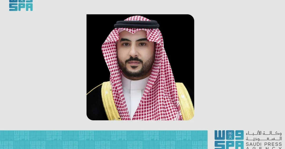
Saudi Arabia will host the 10th Forum of the Arab Division of Experts on Geographical Names in Jeddah from November 10 to 12, 2024, under the patronage of Prince Khalid bin Salman bin Abdulaziz, Minister of Defense and Chairman of the Board of Directors of the General Authority for Survey and Geospatial Information (GEOSA). The event, announced through official Saudi channels via the Saudi Press Agency, brings together representatives from 22 Arab countries alongside international organizations under the theme “Strengthening relations and links between Arab states in the field of geographical names.”
The forum represents a significant milestone in Arab cooperation on geographic naming standards, cultural preservation, and the integration of advanced geospatial technologies. It also underscores Saudi Arabia’s expanding leadership role in multilateral scientific and cultural initiatives, particularly as the Kingdom continues to position itself as a hub for international dialogue and knowledge exchange. How does a discipline as specialized as geographical names connect to the broader ambitions of a nation transforming its economy and global standing? The answer lies in the intersection of identity, technology, and diplomacy that this forum embodies.
Context and Background
Geographical names, or toponyms, are far more than labels on a map. They encode history, heritage, language, and the collective memory of communities across generations. Across the Arab world, geographical names reflect layers of civilizations — from ancient trade routes and tribal settlements to modern urban centers — making their standardization and preservation a matter of cultural urgency as well as administrative necessity. Isn’t it remarkable how a single place name can carry centuries of meaning? The Arab Division of Experts on Geographical Names was established precisely to address this complexity, providing a regional platform for specialists to harmonize approaches, share research, and coordinate with global bodies.
The forum’s tenth edition carries particular weight because it arrives at a moment when digital mapping, artificial intelligence, and geospatial analytics are reshaping how nations manage geographic information. The General Authority for Survey and Geospatial Information, known as GEOSA, has been at the forefront of Saudi Arabia’s efforts in this domain, building national capabilities that serve both domestic development priorities and international cooperation. Under the patronage of Prince Khalid bin Salman bin Abdulaziz, the event reflects the sustained attention that Saudi leadership has devoted to surveying, mapping, and geospatial intelligence as strategic national assets.
Hosting the forum in Jeddah also carries symbolic resonance. The city, long recognized as a gateway to the Kingdom and a historic crossroads for pilgrims, merchants, and scholars, provides an appropriate setting for discussions about how names connect places to people. Participants will engage with programs and activities spanning government, private, academic, and non-profit sectors, ensuring that the conversations extend beyond technical circles into the broader fabric of society.
Key Details and Forum Objectives
The three-day forum will feature a comprehensive agenda designed to facilitate the exchange of ideas, experience, and visions among specialists in geographical names. According to information released through official Saudi channels, key topics include the activities of Arab countries in the field of geographical names, the interpretation and meaning of these names, and their integration into geospatial technologies and artificial intelligence systems. Isn’t it fascinating that the names our ancestors gave to places can now be processed, analyzed, and preserved through machine learning? This convergence of heritage and innovation sits at the heart of the forum’s mission.
Another central theme is the development and management of digital dictionaries for geographical names, built to international standards. These dictionaries serve as authoritative references that support navigation, urban planning, disaster response, and cultural documentation. The forum will also address the unification of names in classical Arabic, a goal that promotes consistency across borders while respecting regional linguistic diversity. Dr. Eng. Mohammed Alsayel, President of GEOSA and Chairman of the National Committee for Geographical Names, highlighted the significance of the event, noting the ongoing support from the Kingdom’s leadership and underscoring Saudi Arabia’s leading positive role in the United Nations Group of Experts on Geographical Names.
The participation of representatives from 22 Arab countries, alongside international organizations, gives the forum a genuinely multilateral character. Delegates will have the opportunity to present national experiences, compare methodologies, and identify areas for joint action. The inclusion of academic and non-profit sector participants ensures that discussions benefit from independent research and community perspectives, enriching the technical deliberations with cultural and social insight.
International and Regional Impact
The forum’s emphasis on strengthening relations and links between Arab states reflects a broader recognition that geographical information is a shared resource requiring coordinated stewardship. When neighboring countries adopt compatible standards for naming and mapping, the benefits ripple across transportation, trade, environmental management, and emergency response. Doesn’t it make sense that cooperation on something as fundamental as place names could unlock practical advantages for millions of people? By hosting this gathering, Saudi Arabia is facilitating exactly that kind of regional integration.
Beyond the Arab world, the forum connects to the work of the United Nations Group of Experts on Geographical Names, the global body responsible for promoting standardization and the preservation of indigenous and minority names. Saudi Arabia’s active engagement in this international framework demonstrates the Kingdom’s commitment to contributing constructively to global governance in scientific and cultural domains. The presence of international organizations at the Jeddah forum will provide Arab delegates with direct access to global best practices and emerging trends.
The event also reinforces the cultural dimension of Saudi diplomacy. By championing the preservation and interpretation of Arab geographical names, the Kingdom affirms the importance of cultural identity in an era of rapid globalization. This approach aligns with a wider recognition that sustainable development must respect and build upon local heritage rather than erase it. The forum thus serves both a technical and a cultural purpose, demonstrating how specialized expertise can advance shared Arab interests on the world stage.
Economic and Strategic Significance
The economic dimensions of geographical naming may not be immediately obvious, but they are substantial. Accurate, standardized geospatial data underpins sectors ranging from logistics and real estate to tourism and agriculture. Digital dictionaries and unified naming conventions reduce friction in cross-border operations, support the growth of location-based services, and enhance the reliability of national statistics. Isn’t it striking how a seemingly academic exercise can translate into tangible economic efficiency? For Arab economies seeking to diversify and modernize, these foundations matter enormously.
Saudi Arabia’s investment in geospatial infrastructure through GEOSA forms part of a broader strategic push to build knowledge-based capabilities. The Kingdom’s Vision 2030 agenda emphasizes digital transformation, innovation, and the creation of high-value jobs, and the geospatial sector sits squarely within that vision. By convening experts from across the region, the forum helps cultivate a community of practice that can drive innovation, attract talent, and develop technologies with export potential. The exchange of ideas and experiences among specialists is therefore not merely an academic exercise but an investment in future economic capacity.
Strategic considerations also come into play. Reliable geographic information supports national security, border management, and infrastructure planning. Cooperation among Arab states on naming standards enhances interoperability and reduces the risk of miscommunication in critical situations. The forum’s discussions on integrating names into geospatial technologies and AI point toward a future in which location intelligence plays an even greater role in governance and commerce. Saudi Arabia’s leadership in this field positions the Kingdom as a trusted partner for countries seeking to modernize their own systems.
Vision 2030 Alignment
The 10th Forum of the Arab Division of Experts on Geographical Names aligns closely with the objectives of Saudi Vision 2030, the national transformation blueprint championed by Crown Prince Mohammed bin Salman. Vision 2030 seeks to diversify the economy, strengthen international partnerships, and enhance the Kingdom’s cultural and scientific standing. Hosting a major regional forum in Jeddah advances all three goals simultaneously, showcasing Saudi Arabia’s convening power and its commitment to knowledge exchange. Doesn’t this demonstrate how specialized initiatives can serve a grand national vision? The connection is direct and deliberate.
Moreover, the forum supports the Vision 2030 emphasis on preserving national heritage while embracing modernity. Geographical names are vessels of heritage, and their systematic documentation ensures that future generations retain access to the stories embedded in the landscape. At the same time, the integration of these names into AI and geospatial platforms represents the kind of technological adoption that Vision 2030 promotes. By bridging tradition and innovation, the forum embodies the balanced progress that the Kingdom seeks to achieve.
As the event unfolds from November 10 to 12, it will serve as a testament to Saudi Arabia’s growing role as a hub for regional and international cooperation. The outcomes — from strengthened networks to shared technical standards — will extend well beyond the conference halls, contributing to a more connected and culturally confident Arab world. For international observers, the forum offers a window into how the Kingdom is leveraging specialized expertise to advance both its own development and the common good of the region.
20 Questions
Q1. What is the 10th Forum of the Arab Division of Experts on Geographical Names?
A1. It is a regional gathering hosted by Saudi Arabia in Jeddah from November 10 to 12, 2024, bringing together experts from 22 Arab countries and international organizations to discuss geographical naming standards, cultural preservation, and geospatial technology integration.
Q2. Who is patronizing the forum?
A2. Prince Khalid bin Salman bin Abdulaziz, Minister of Defense and Chairman of the Board of Directors of the General Authority for Survey and Geospatial Information (GEOSA), is patronizing the event, reflecting high-level Saudi support for geospatial and cultural initiatives.
Q3. Where and when will the forum take place?
A3. The forum will be held in Jeddah, Saudi Arabia, from November 10 to 12, 2024. Jeddah serves as a historic gateway city and a fitting venue for discussions on geography, heritage, and international cooperation.
Q4. What is the theme of the forum?
A4. The theme is “Strengthening relations and links between Arab states in the field of geographical names.” It emphasizes regional cooperation, cultural identity, and the sharing of expertise among Arab nations and international partners.
Q5. How many countries are participating?
A5. Representatives from 22 Arab countries are participating, along with international organizations. This broad participation underscores the forum’s role as a platform for multilateral dialogue and joint Arab action.
Q6. What are the main objectives of the forum?
A6. The forum aims to exchange ideas and experiences among specialists, enhance Arab cultural identity, support joint Arab initiatives, and foster connections with international organizations working on geographical names and geospatial standards.
Q7. What key topics will be discussed?
A7. Key topics include Arab countries’ activities in geographical names, interpretation of names, integration with geospatial technologies and AI, development of digital dictionaries to international standards, and unification of names in classical Arabic.
Q8. Who is Dr. Eng. Mohammed Alsayel?
A8. Dr. Eng. Mohammed Alsayel is the President of GEOSA and Chairman of the National Committee for Geographical Names. He highlighted the forum’s significance and Saudi Arabia’s leading role in the United Nations Group of Experts on Geographical Names.
Q9. What is GEOSA?
A9. GEOSA is the General Authority for Survey and Geospatial Information, a Saudi government agency responsible for surveying, mapping, and geospatial data. It supports national development and international cooperation in geospatial fields.
Q10. Why are geographical names important?
A10. Geographical names preserve cultural heritage, history, and identity. They also support navigation, urban planning, disaster response, and digital mapping, making their standardization and documentation essential for modern societies.
Q11. How does the forum relate to technology?
A11. The forum explores integrating geographical names into geospatial technologies and artificial intelligence, including digital dictionaries. This fusion of heritage and innovation enhances data accuracy and supports location-based services and research.
Q12. What is the role of the United Nations in this field?
A12. The United Nations Group of Experts on Geographical Names promotes standardization and preservation of names globally. Saudi Arabia actively participates, and the forum strengthens Arab engagement with this international framework.
Q13. What are digital dictionaries of geographical names?
A13. Digital dictionaries are authoritative electronic references that document place names, their meanings, and standardized spellings. They support navigation, planning, and cultural preservation, and are developed according to international standards.
Q14. Why unify names in classical Arabic?
A14. Unifying names in classical Arabic promotes consistency across borders, reduces confusion, and respects linguistic heritage. It facilitates communication, mapping, and legal documentation among Arab states.
Q15. How does the forum benefit Saudi Arabia?
A15. Hosting the forum enhances Saudi Arabia’s leadership in geospatial fields, supports Vision 2030 goals, strengthens regional ties, and showcases the Kingdom’s commitment to cultural preservation and technological innovation.
Q16. What sectors are involved in the forum?
A16. The forum involves government, private, academic, and non-profit sectors, ensuring diverse perspectives and comprehensive discussions on geographical names and their applications.
Q17. How does this event support Arab cultural identity?
A17. By documenting and interpreting geographical names, the forum helps preserve Arab heritage, language, and history, reinforcing a shared cultural identity across the region.
Q18. What is the significance of hosting in Jeddah?
A18. Jeddah is a historic gateway city and a crossroads of cultures. Hosting there symbolizes openness, connectivity, and the link between geography, trade, and pilgrimage heritage.
Q19. What outcomes are expected from the forum?
A19. Expected outcomes include strengthened regional networks, shared technical standards, enhanced cooperation with international organizations, and progress on digital dictionaries and AI integration for geographical names.
Q20. How does the forum align with Vision 2030?
A20. The forum aligns with Vision 2030 by promoting knowledge exchange, cultural preservation, digital transformation, and international partnerships, reinforcing Saudi Arabia’s role as a regional hub for innovation and cooperation.
Reader Feedback
We value your thoughts. Please share your feedback on this article.
Your feedback helps us improve our coverage.
Related articles
 ARABOSAI Capacity Building Committee Holds 24th Meeting in Jeddah
 Saudi Arabia Opens Middle East’s Largest Film Studios
 Shura Council Speaker Receives Turkish Ambassador
 KSrelief Chief Meets Turkmenistan Ambassador in Riyadh
 19th Saudi Relief Plane Arrives in Lebanon with Aid
 Egyptian PM Visits Saudi Pavilion at World Urban Forum