


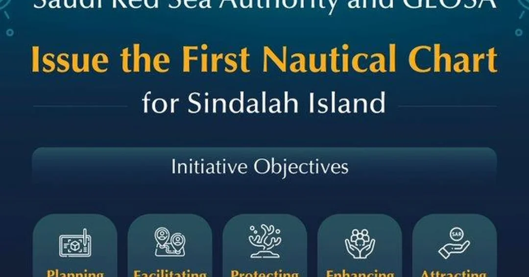
The Saudi Red Sea Authority (SRSA), in collaboration with the General Authority for Survey and Geospatial Information (GEOSA), has issued the first high-resolution paper and electronic navigational nautical chart of Sindalah Island in the NEOM region, alongside four additional maps covering the broader NEOM area. The announcement, released through official Saudi channels, marks a significant step in the Kingdom’s efforts to regulate and develop its coastal tourism sector while enhancing marine safety and environmental protection. The charts were produced according to the latest international standards and in full accordance with International Hydrographic Organization (IHO) specifications, reflecting Saudi Arabia’s commitment to world-class maritime infrastructure.
Could this development signal a new era for yachting and marine tourism in the Red Sea? For international observers, the release of these charts is more than a technical milestone. It represents a carefully coordinated effort between two key Saudi authorities to unlock the economic potential of the Kingdom’s extensive coastline, which stretches for approximately 1,800 kilometers along the Red Sea. Sindalah Island, a luxury destination within the NEOM giga-project, is poised to become a premier gateway for yacht owners and marine tourists from around the world. The new charts provide the reliable geospatial data necessary to navigate these waters safely, supporting the broader ambitions of Saudi Vision 2030 to diversify the economy and establish the Kingdom as a global tourism hub.
Context and Background
Why is the Red Sea so central to Saudi Arabia’s economic transformation? The Saudi Red Sea Authority was established in 2021 to build and regulate the coastal tourism sector, a mandate that includes identifying navigation routes for marine activities within Saudi Arabia’s geographical scope, developing and updating them in coordination with relevant entities, and ensuring environmental protection. Since its inception, SRSA has worked to enhance integration among government bodies by issuing licenses and permits, developing policies and strategies, determining infrastructure requirements, preserving the marine environment, enabling investment, and promoting navigational and marine tourism activities. These efforts are designed to add value to the national economy and create new opportunities for international investors and travelers.
Meanwhile, GEOSA is responsible for regulating the surveying and geospatial information sector in Saudi Arabia. Its work includes adopting and developing the national geospatial infrastructure, the national geodetic reference, national geodetic networks, hydrographic surveying, and providing data, products, services, electronic applications, topographic and aerial maps, and maritime navigation charts. The collaboration between SRSA and GEOSA on the Sindalah charts is a direct result of their complementary mandates, combining SRSA’s regulatory and developmental role in coastal tourism with GEOSA’s technical expertise in geospatial data. Together, they have produced a tool that will serve both public and private stakeholders, from yacht captains to coastal developers.
The timing of this release is significant. NEOM, the Kingdom’s flagship giga-project, is rapidly taking shape, and Sindalah Island is expected to welcome its first visitors in the near future. Without accurate nautical charts, large yachts and other vessels would face unnecessary risks when approaching the island. The new charts mitigate those risks by providing detailed information on depths, coral reefs, islands, navigation hazards, and tidal patterns. This is particularly important in the Red Sea, which is known for its complex underwater topography and ecologically sensitive coral reefs. By adhering to IHO standards, Saudi Arabia is signaling that its marine infrastructure meets the highest global benchmarks.
Key Details of the Nautical Charts
What exactly do these charts contain, and why do they matter for marine safety? According to official information, the charts include high-resolution data on water depths, the location of coral reefs, the positions of islands, potential navigation hazards, and tidal information. This data is essential for safe navigation, allowing vessels to plot courses that avoid shallow areas and protected marine environments. The charts are available in both paper and electronic formats, catering to different user preferences and onboard systems. The electronic versions can be integrated into modern navigation suites, supporting smart decision-making by captains and fleet operators. In addition to the Sindalah chart, four other maps of the NEOM region have been produced, providing comprehensive coverage of this emerging maritime destination.
GEOSA implemented the highest standards for producing and updating these charts, ensuring that they are reliable and secure. The charts also contribute to environmental protection by identifying sensitive areas such as coral reefs, which are vital to the Red Sea’s biodiversity. By marking these areas clearly, the charts help prevent accidental anchor damage and other harmful activities. Furthermore, the charts include information on navigational aids such as buoys, which enhance marine safety by guiding vessels through safe channels. This combination of safety and environmental data makes the charts a valuable resource for anyone operating in the region, from luxury yacht owners to commercial shipping operators.
The production of these charts is part of a broader effort to develop and update navigation routes in coordination with relevant entities. SRSA’s mandate includes not only identifying these routes but also ensuring they are regularly updated to reflect changing conditions. This is particularly important in the Red Sea, where shifting sands and coral growth can alter underwater landscapes over time. By keeping charts current, SRSA and GEOSA are helping to maintain a safe and efficient maritime environment that supports the growth of coastal tourism. The charts also facilitate the entry and exit of yachts and other watercraft to Sindalah and other islands, making it easier for international visitors to explore the Red Sea’s pristine waters.
International and Regional Impact
How will these charts influence the Red Sea’s standing as a global yachting destination? For international yacht owners and marine tourists, the availability of accurate nautical charts is a prerequisite for planning a voyage. Without them, many would avoid unfamiliar waters, especially in regions with complex reef systems. The new charts remove a significant barrier to entry, making the Red Sea more accessible to the global yachting community. This could lead to an increase in yacht traffic, which in turn would support the development of marinas, provisioning services, and other marine infrastructure. Neighboring countries such as Egypt and Jordan also benefit from a safer Red Sea, as improved navigation reduces the risk of accidents that could affect shared waters.
On a regional level, the charts reinforce Saudi Arabia’s position as a leader in maritime safety and environmental stewardship. The Kingdom is a member of the International Hydrographic Organization, and its adherence to IHO standards demonstrates its commitment to international cooperation. This is particularly important as the Red Sea gains prominence as a strategic waterway for global trade and tourism. By investing in high-quality hydrographic data, Saudi Arabia is contributing to the safety of all vessels transiting the region, not just those destined for Saudi ports. The charts also support the broader goals of Vision 2030 by attracting foreign investment and showcasing the Kingdom’s ability to deliver world-class infrastructure.
Economic and Strategic Significance
What economic opportunities will these charts unlock for Saudi Arabia? The coastal tourism sector is a key pillar of Vision 2030, which aims to increase the tourism sector’s contribution to GDP and create jobs for Saudi citizens. By providing the navigational data needed to support yacht tourism, the charts help attract high-spending visitors who can stimulate local economies. Sindalah Island, with its luxury resorts and marina, is designed to cater to this demographic. The charts also support investment in coastal developments by reducing the perceived risk of navigating unfamiliar waters. Developers can plan with confidence, knowing that accurate hydrographic data is available.
Strategically, the charts enhance Saudi Arabia’s ability to manage its marine environment. The Red Sea is home to some of the world’s most resilient coral reefs, and protecting them is a priority for the Kingdom. By marking reefs and other sensitive areas, the charts help prevent damage from anchoring and grounding. This aligns with Saudi Arabia’s environmental commitments, including the Saudi Green Initiative, which aims to protect and restore marine ecosystems. The charts also support smart decision-making by providing data that can be used for marine spatial planning, ensuring that development is balanced with conservation. In the long term, this integrated approach will help sustain the Red Sea’s ecological health while enabling economic growth.
Vision 2030 Alignment
How does this achievement reflect the broader aspirations of Saudi Vision 2030? Vision 2030 is a comprehensive plan to diversify the Kingdom’s economy, reduce its dependence on oil, and create a vibrant society. Tourism is a central component, with targets to attract 100 million visitors annually by 2030. The Red Sea coast, with its pristine beaches and coral reefs, is a key asset in this effort. The nautical charts for Sindalah and the NEOM region are a concrete example of how Vision 2030 is being implemented on the ground, bringing together government entities to deliver infrastructure that enables private sector growth. By facilitating yacht tourism and coastal investment, these charts contribute directly to the economic diversification goals of the Vision.
Moreover, the collaboration between SRSA and GEOSA exemplifies the integrated governance approach that Vision 2030 promotes. Rather than working in silos, government agencies are coordinating to achieve shared objectives. This is essential for complex projects like NEOM, which require input from multiple authorities. The charts also enhance Saudi Arabia’s global role by demonstrating its commitment to international standards and environmental protection. As the Kingdom continues to develop its Red Sea coastline, such initiatives will be crucial in building a sustainable and prosperous future. The release of these charts is a clear signal that Saudi Arabia is open for business, ready to welcome the world to its shores, and dedicated to preserving its natural treasures for generations to come.
20 Questions
Q1. What is the significance of the first nautical chart for Sindalah Island?
A1. It provides high-resolution navigational data essential for safe marine access to Sindalah, supporting tourism and investment in the NEOM region while adhering to International Hydrographic Organization standards.
Q2. Which Saudi authorities collaborated on this project?
A2. The Saudi Red Sea Authority (SRSA) and the General Authority for Survey and Geospatial Information (GEOSA) collaborated to produce the charts, combining regulatory and technical expertise.
Q3. What information is included in the nautical charts?
A3. The charts include data on depths, coral reefs, islands, navigation hazards, and tidal information to enhance marine safety and support smart decision-making.
Q4. How do these charts support Saudi Vision 2030?
A4. They facilitate investment in coastal tourism, enhance marine safety, and promote navigational and marine tourism activities, aligning with Vision 2030’s economic diversification goals.
Q5. What is the role of the Saudi Red Sea Authority?
A5. SRSA regulates and develops the coastal tourism sector, issuing licenses, developing policies, determining infrastructure needs, preserving the marine environment, and enabling investment.
Q6. What is GEOSA’s mandate?
A6. GEOSA regulates surveying and geospatial information, develops national geospatial infrastructure, and provides hydrographic surveying, maps, and maritime navigation charts.
Q7. Why are the charts important for yacht tourism?
A7. They provide reliable navigational data that makes it easier and safer for yachts to enter and exit Sindalah and other islands, attracting international yacht owners.
Q8. How do the charts contribute to environmental protection?
A8. By marking coral reefs and sensitive areas, the charts help prevent anchor damage and grounding, supporting the preservation of the Red Sea’s marine ecosystems.
Q9. What international standards were followed?
A9. The charts were produced in accordance with International Hydrographic Organization standards, ensuring high quality and global compatibility.
Q10. How many maps were produced in total?
A10. In addition to the Sindalah chart, four other maps of the NEOM region were produced, providing comprehensive coverage of the area.
Q11. When did SRSA begin its work?
A11. SRSA began its journey toward building and regulating the coastal tourism sector in 2021, following its establishment by the Saudi government.
Q12. What are the economic benefits of these charts?
A12. They attract investment in coastal tourism, support job creation, and enhance the national economy by enabling marine tourism activities and yacht visits.
Q13. How do the charts enhance marine safety?
A13. By providing accurate data on depths, hazards, and tidal patterns, and by identifying navigational aids like buoys, the charts reduce the risk of accidents.
Q14. What is the significance of Sindalah Island?
A14. Sindalah is a luxury destination within NEOM, designed to be a premier yachting and tourism hub, and the charts are vital for its accessibility.
Q15. How does this project reflect integrated governance?
A15. It demonstrates collaboration between SRSA and GEOSA, pooling their mandates to deliver a critical infrastructure asset efficiently and effectively.
Q16. What is the Red Sea’s importance to Saudi Arabia?
A16. The Red Sea coastline is a key asset for tourism development, offering pristine reefs and beaches that can attract millions of visitors and diversify the economy.
Q17. Will the charts be updated regularly?
A17. Yes, SRSA’s mandate includes developing and updating navigation routes in coordination with relevant entities to ensure ongoing safety and accuracy.
Q18. How do these charts support smart decision-making?
A18. They provide reliable geospatial marine data that can be integrated into electronic navigation systems, helping captains and planners make informed choices.
Q19. What role do the charts play in attracting foreign investment?
A19. By reducing navigational risks and showcasing high standards, the charts make the Red Sea more attractive to international investors in tourism and marine infrastructure.
Q20. What does this achievement say about Saudi Arabia’s global role?
A20. It highlights the Kingdom’s commitment to international standards, environmental stewardship, and economic openness, reinforcing its position as a leading maritime tourism destination.
Reader Feedback
We value your thoughts. Please share your feedback on this article.
Your feedback helps us improve our coverage.
Related articles
 Shebara Luxury Resort Opens Reservations at The Red Sea
 Saudi Tourism Licenses Surge 99%, Rooms Up 107%
 Winter at Tantora Festival Returns to AlUla This December
 Over 58 Tons of Zamzam Water Distributed at Prophet’s Mosque
 Saudi Arabia Unveils New Destinations at WTM London
 AlUla Wellness Festival Concludes After 17 Inspiring Days